In May this year, somebody deliberately set the Slieve Beagh peatland in Northern Ireland on fire – triggering a local trust to trust drone technology with catching the next person attempting to commit arson in the area.
Reports from the UK have it that the River Blackwater Catchment Trust (RBCT) is trialling a set of surveillance drones patrolling the Slieve Beagh peatland, after the northern section was destroyed in a wildfire started deliberately in May.
The RBCT is a cross-border, non-profit environmental charity established in 2013 to protect, conserve, and improve the rivers and habitats within the River Blackwater catchment area, which spans parts of Ireland and Northern Ireland.
The trust works with communities and landowners to implement practical, nature-based solutions to enhance water quality, biodiversity, and ecosystems by promoting sustainable land management practices.
For this latest project, the trust plans to use large agricultural spraying drones in the long term, to help dampen fires in hard-to-reach areas when they are detected.
"It's so hard to catch people lighting fires in these remote areas and bring prosecutions but using technology, that's changing," said the RBCT's environmental project officer, Roy Spence.
"We have CCTV options as well, but CCTV combined with drones should be a very, very strong deterrent for anyone with this crazy idea that it's okay to light fires and burn our wild areas."
The cross-border blanket bog covers parts of Tyrone, Fermanagh and Monaghan.
It is home to endangered species, as well as being a huge carbon "sink", storing greenhouse gas emissions when in healthy condition.
The Slieve Beagh bog itself is about 3,000 hectares, which expands to around 9,000ha when forestry and the surrounding designated areas are taken into account.
But Spence reckons the peatland "needs something physically there" to protect it.
Up to three drones with infrared thermal-imaging payloads will be used during the high-risk fire season next year to patrol the area.
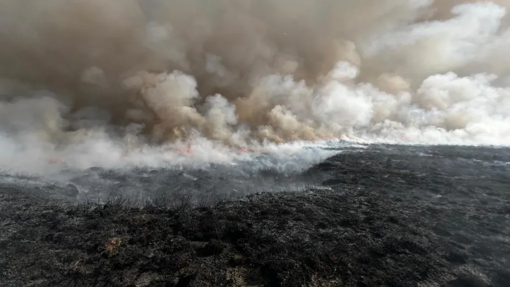
"They'll find a fire, they'll take a photograph of it in 5K definition, and then send that to a coordinator's phone who'll look at that image and say, it's a farmer burning some rushes, or it's a deer, or it is a wildfire, and once we get that image, it means we can deploy and get to that fire as quick as possible."
Tackling wildfires in an area like Slieve Beagh is a horrendous job, according to Spence, especially when conventional transport cannot easily get to areas on the upland bog.
It can mean hours walking long distances, carrying heavy knapsacks filled with water for spraying and putting firefighters at risk from moving flames.
So using agricultural drones that can carry up to one hundred litres of water and fly above any fire is a pioneering solution the Trust is going to test out.
Spence's hopes are high.
"We believe that someday, not today or tomorrow, but someday, our little surveillance drone can find a fire and talk to this (spraying) drone to say we've got a fire here and that can go and put it out without people ever being involved."
Ideally, there would be no more wildfires and the large water-carrying drone would be "the biggest waste of money ever".
But Roy describes it and the patrol drones as "a very useful tool" in the worst-case scenario of continuing wildfire problems.
If the plan works for Slieve Beagh, it could be used anywhere that wildfires have been started deliberately.
"It could be a great deterrent," said Roy.
"I mean, it's going to be very, very off-putting for anyone to go out there and light a fire when they know that there's drones going over there at random times, and they could be filmed in 5K setting that fire."